With the nation in another lockdown but construction allowed to continue, it poses a dilemma for many developers, contractors and consultants who may have been forced to furlough or ask staff to work from home (WfH).
Construction monitoring and oversight is crucial to ensure projects are completed to specification, on time and to budget. If your organization is engaged with multiple projects, then this means having to send staff to those sites to witness what progress has been made and report back to stakeholders.
Site Visits Affected by Health Risks
This clearly presents a serious risk to the health of not only the staff making those visits, but those working on each site – as well as a significant risk to your organization.
As concern grows over the potential spread of the virus through construction site staff, the need to reduce site visits has never been greater.
Remote Access to Aerial Construction Site Monitoring
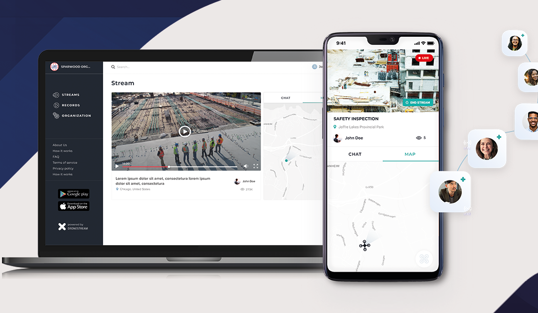
As virtual meetings and video conferencing have become the norm, construction site data can now also be reviewed, interrogated and communicated with all stakeholders completely remotely.
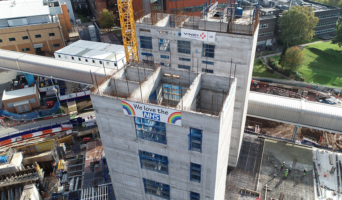
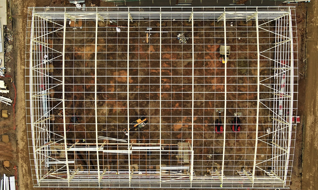
Drones present an efficient means of observing your site. 4K video footage and high resolution still imagery captured remotely by drone being streamed live to your device at home can significantly reduce the number of site visits required – reducing risk as well as costs and carbon.
Speak directly to the pilot whilst observing the live site data, guiding the drone to specific areas of interest. The recorded footage can then be edited to produce short site overviews to share with stakeholders and create marketing material promoting your project.
Site mapping by drone is much faster and safer than traditional methods as the surveyor/pilot has no need to walk the site. Topographical maps and Digital Elevation Models (DTMs) are made available to you at very low latency meaning important decision can be made without delay.

Online Realtime Delivery of Data
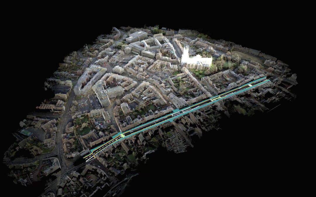
Presented through online data management software, a digital replica of your project can be used to track progress through key milestones and to reference site information. DTMs and other topographical data is accessible to all stakeholders and creates a single source of truth during the on site phase of the project.
It’s not all aerial data – drone data can be combined with terrestrial data to get a more complete view of your site. Virtual reality walk throughs of buildings captured at significant build stages (such as post M&E install, pre plasterboard) provide not only a digital environment in which to reference, analyze and communicate as built information, but an accurate record of component location and condition.
By continuing to capture and digitize site information during the construction phase allows the ‘as built’ to be directly cross checked against the ‘as designed’ Building Information Model (BIM) – ultimately resulting in less discrepancies; better quality and reduced costs.
Our Blog
Understanding Operations Safety Case (OSC)
Understanding the Drone Operations Safety Case (OSC) and Standard Permissions Under PDRA01As drone technology rapidly evolves, businesses are...

Unleashing Speed and Efficiency through Cloud Processing
Cloud Processing In today’s digital age, the volume of data generated by various industries is growing exponentially, and the field of surveying is...
Point Clouds 101: Understanding the Digital 3D World
Point Clouds Explained Welcome to the fascinating world of Point Clouds! In this blog post, we will take you on a journey through the basics of...
The Evolution of Surveying: How Drones are Reshaping the Industry
Traditional vs ModernSurveying is a fundamental aspect of many industries, providing crucial data for planning, design, and construction projects....
Safe Access Construction Quality Inspections
A staple on almost any construction site, is the mobile elevating work platform (MEWP), commonly referred to as a ‘cherry picker’. Often multiple...
Dawn of the digital surveyor – site visits from home
With the Government travel restrictions remaining in place for the foreseeable future, both domestic and international, site visits have become a...
 Owen Jenkins
 Danny Mckeown