![]()
The Challenge
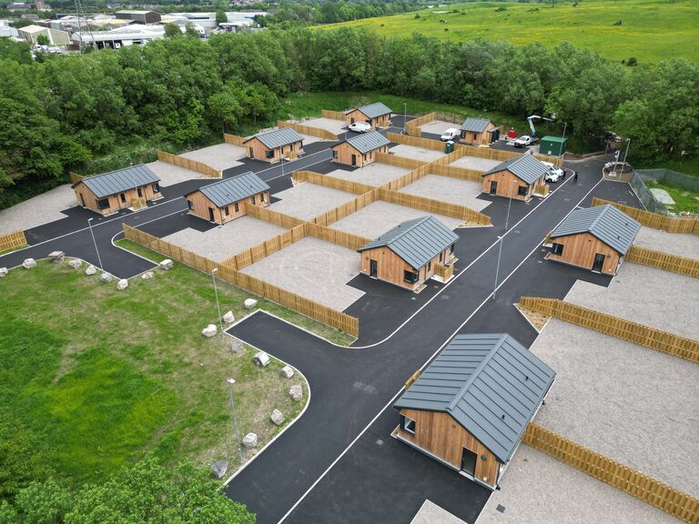
To effectively document and represent the condition of a newly completed site development before handover, ensuring the data can be referenced in the future.
Nationwide Drones Response
Advanced Aerial and Ground Data Collection
- Drones for Aerial Representation: Utilising high-resolution drones, we captured detailed aerial imagery and video footage, offering a complete overview of the site from various perspectives.
- Mobile Laser Scanning: Both the interior and exterior of each building were digitized using state-of-the-art mobile laser scanning technology, ensuring high accuracy and detail.
Meticulous Pre-Flight Planning
- Standard Drone Survey Protocols: We adhered to our rigorous protocols, starting with meticulous pre-flight planning to ensure comprehensive coverage and data accuracy.
- Desktop Planning Tools: Our team leveraged advanced planning tools to chart out precise flight missions, enhancing operational efficiency and effectiveness.
Systematic and Precise Data Capture
- High-Resolution Visual Data: Systematically captured high-resolution images and videos, each referenced to its exact location and orientation on the site.
- Detailed Site Maps and Models: Created up-to-date site maps and 3D models, providing our clients with current perspectives and facilitating precise measurements.
Project Deliverables
-
3D Digital model of each the whole site
-
Interactive walk through tour
- Drone Media
- Promotional Video
Promotional Video
Drone 360 Panoramas
Recent Projects

Museum digitisation
Warwickshire County Council faced the challenge of modernising the management of Warwick’s iconic Market Hall Museum, a 17th-century landmark, while...
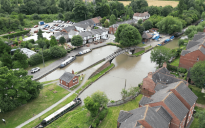
The Grand Union Canal Transfer
The Challenge Affinity Water tasked us with creating a compelling video to showcase their ambitious plan to transport water from the Midlands to the...
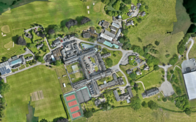
Ellesmere College – Roof inspection
The ChallengeIn January 2024, following the powerful Storm Isha, Ellesmere College required a rapid and accurate inspection of their extensive...
 Owen Jenkins
 Danny Mckeown