Commercial drone capture for West Midlands. CAA enhanced permissions, surveyor-led delivery, every project hosted on AIM Platform. From Birmingham city-centre roof inspections to estate-wide thermal surveys.
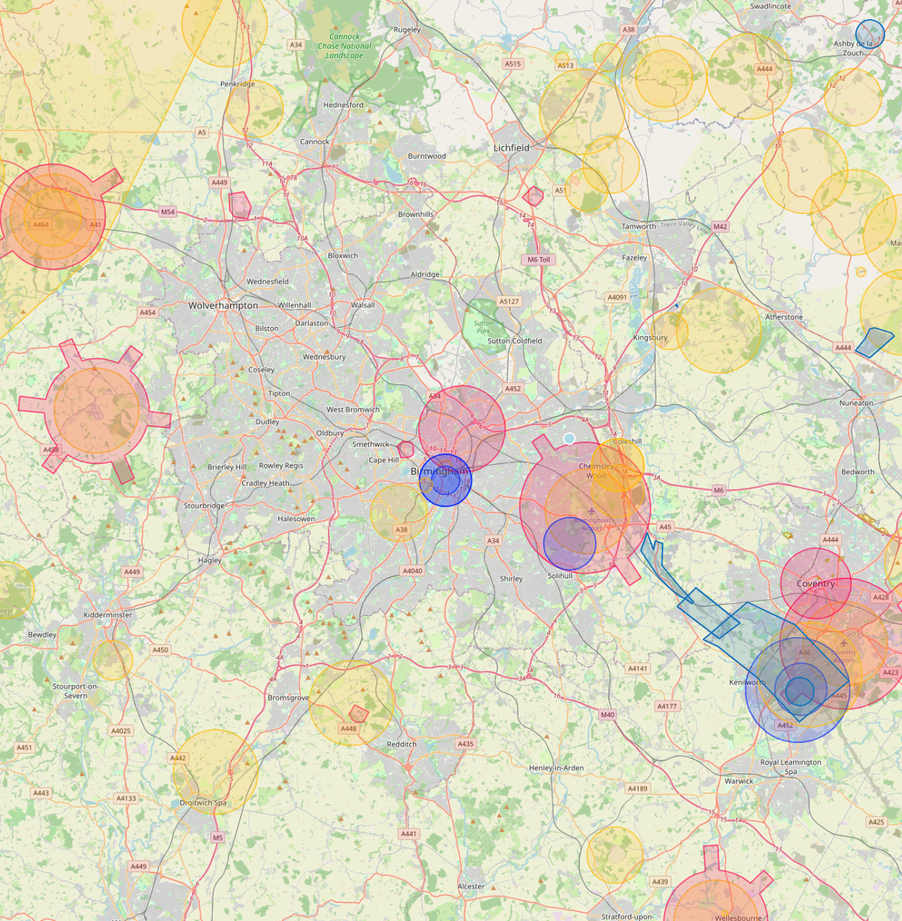
Birmingham Airport CTR covers the eastern half of the city. The Coventry Airport FRZ sits 10km south-east. Network Rail manages New Street, Moor Street and Snow Hill plus the West Coast Main Line through the city. Film Birmingham issues filming permissions for city-centre work.
Live airspace data from Altitude Angel via Drone Safety Map. Pan and zoom to explore restrictions around your site.
Where Birmingham clients send us
Common Birmingham project types.
Construction (HS2 stations), commercial property, manufacturing facilities, public-sector housing, university estates, transport infrastructure.
Why Birmingham firms use us
Permissions that match the airspace.
Birmingham is one of the UK's largest construction zones right now. We provide ongoing aerial monitoring across the HS2 corridor, Smithfield regeneration and Paradise development with monthly capture hosted on AIM for the project team to compare visit-to-visit.
Services in Birmingham
What we capture across the Birmingham area.
✓
Drone roof and gutter inspection Commercial and residential roof surveys, façade inspections, gutter checks, without scaffold or MEWP. Same-week scheduling.
✓
Thermal heat-loss and BREEAM surveys Calibrated thermal capture for retrofit planning, EPC support, and BREEAM compliance. Night-time and daytime where appropriate.
✓
Construction monitoring Monthly or weekly aerial capture for active construction sites. Time-series comparison hosted on AIM.
✓
Topographical and measured surveys Centimetre-grade ground capture, CAD drawings, Revit / BIM models, full 3D measured surveys for refurbishment and change-of-use.
✓
Confined space inspection Specialist drones for tank, tunnel, vessel and shaft inspection. No permit-to-enter, no shutdown.
✓
Drone media and 360 capture 4K and 8K drone video, Insta360 ground-level walk-throughs, FPV showcase content.
Local clients we work with
Public-sector and housing-association coverage.
Around Birmingham, our project pipeline regularly takes us across local authority and housing-association estates. We deliver scaffold-free roof inspections, retrofit thermography, condition surveys and BREEAM-grade thermal capture for organisations including:
Local authorities
✓Birmingham City Council
✓Solihull MBC
✓Sandwell MBC
✓Dudley MBC
✓Walsall Council
Housing associations & estates
✓Midland Heart
✓Sanctuary Housing
✓Bromford
✓Housing Plus Group
✓Pioneer Group
Organisation names are common sector-active examples in the region. Specific client engagements are confirmed under NDA on request.
Permissions matter
Approved for business locations, airports, FRZs and restricted areas.
Most of the sites we're asked to fly, live commercial premises, near airports, inside Flight Restriction Zones, around Network Rail corridors, military air bases and Royal estates, require enhanced CAA permissions, prior notification, and an operator with the track record to coordinate with the relevant authority. We hold and operate under those permissions every day. If you've been told "no" elsewhere, our route to flying it is almost certainly already in place.
Every Birmingham project we capture is hosted on AIM Platform, the asset-information software used by surveyors, councils and contractors across the UK. Browser-streamable. Measurable in place. Shareable with one link.
Can you fly drones near Birmingham's controlled airspace?
Yes. We operate routinely under Birmingham Airport CTR. Our enhanced CAA permissions and notification procedures let us fly safely in and around controlled airspace where standard operators are restricted, including airport approach paths and Flight Restriction Zones.
Do you cover Birmingham central areas like Jewellery Quarter and Digbeth?
Yes. We routinely fly across Birmingham including Jewellery Quarter, Digbeth, Bullring and Edgbaston. Dense built-up areas, occupied commercial premises and live retail sites are all within scope under our enhanced CAA approval.
Can you fly drones near BT Tower or other Birmingham landmarks?
Yes, where permitted. Iconic sites like BT Tower sit within or near restricted areas, but we work with the landowner, the relevant authority and the CAA where needed to secure the right permissions. We have a strong track record of getting "no" sites to "yes".
Can you do construction progress monitoring on Birmingham sites?
Yes. Monthly aerial sets, volumetric reports and orthomosaics for active Birmingham construction sites are a core service. Each visit produces a side-by-side comparison against previous visits, hosted on AIM Platform.
What does a typical drone survey deliverable look like in Birmingham?
You receive the captured imagery, measured outputs, and an interactive AIM Platform link for your team. Birmingham jobs are deliverable in the same browser-based viewer used for projects across the UK, no software install, no per-seat licences.
Do you provide thermal drone surveys in Birmingham?
Yes. Thermal surveys are flown across Birmingham for housing portfolios, BREEAM certification work, commercial roof condition checks and solar array inspections. Best results are achieved between October and March.
Quote a drone survey in Birmingham.
Tell us the site, the deliverable, and any access constraints. Most quotes turn around within 24 hours.