Drone surveys, Coventry

Drone surveys across Coventry.

Commercial drone capture for West Midlands. CAA enhanced permissions, surveyor-led delivery, every project hosted on AIM Platform. From Coventry city-centre roof inspections to estate-wide thermal surveys.

Local airspace

Coventry airspace, live.

Coventry Airport FRZ covers the south of the city. Birmingham Airport CTR sits 18km west. Network Rail manages Coventry station and the West Coast Main Line.
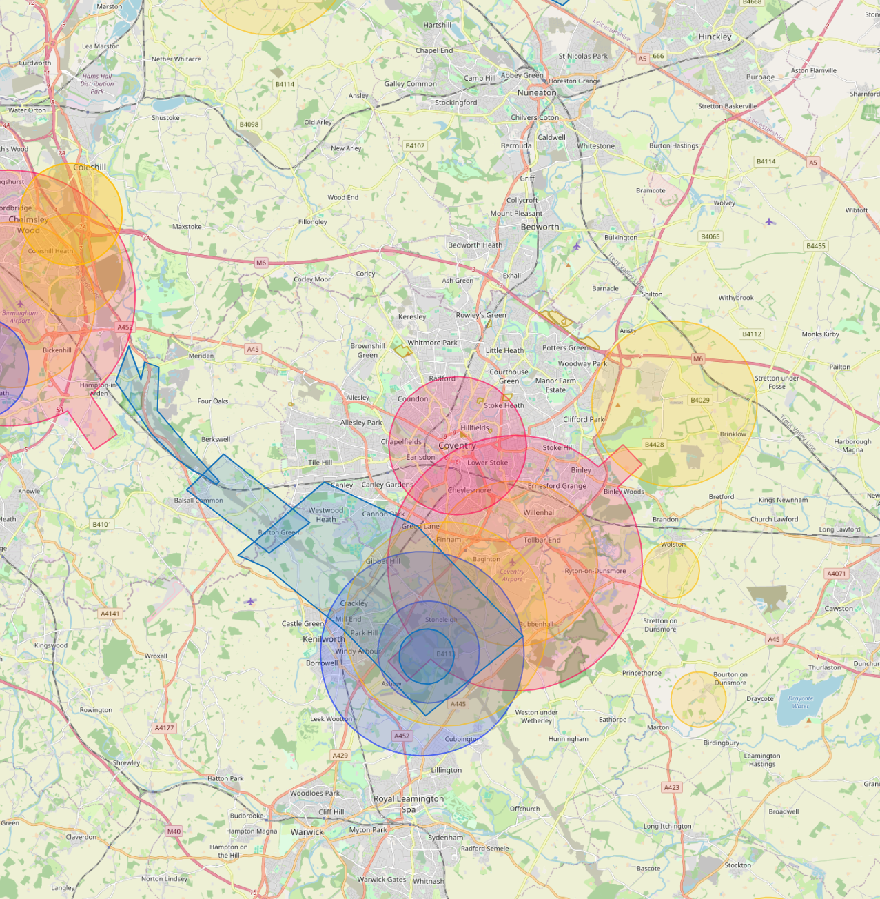
Live flight restrictions and airspace zones around Coventry
Live flight restriction data · Drone Safety Map View live airspace restrictions →
CVT FRZ BHX CTR Network Rail

Live airspace data from Altitude Angel via Drone Safety Map. Pan and zoom to explore restrictions around your site.

Where Coventry clients send us

Common Coventry project types.

Automotive (JLR, LEVC), university estates, public-sector housing, heritage (cathedral quarter), industrial property.

Why Coventry firms use us

Permissions that match the airspace.

Coventry's automotive and advanced manufacturing estate has the largest flat-roof inventory in the West Midlands. Thermal heat-loss surveys here typically pay back inside one heating season.

Services in Coventry

What we capture across the Coventry area.

Local clients we work with

Public-sector and housing-association coverage.

Around Coventry, our project pipeline regularly takes us across local authority and housing-association estates. We deliver scaffold-free roof inspections, retrofit thermography, condition surveys and BREEAM-grade thermal capture for organisations including:

Local authorities

  • Coventry City Council
  • Warwickshire CC
  • Solihull MBC
  • North Warwickshire

Housing associations & estates

  • Citizen Housing
  • Whitefriars Housing
  • Orbit Group
  • Midland Heart

Organisation names are common sector-active examples in the region. Specific client engagements are confirmed under NDA on request.

Permissions matter

Approved for business locations, airports, FRZs and restricted areas.

Most of the sites we're asked to fly, live commercial premises, near airports, inside Flight Restriction Zones, around Network Rail corridors, military air bases and Royal estates, require enhanced CAA permissions, prior notification, and an operator with the track record to coordinate with the relevant authority. We hold and operate under those permissions every day. If you've been told "no" elsewhere, our route to flying it is almost certainly already in place.

Powered by AIM

Coventry captures, on AIM Platform.

Every Coventry project we capture is hosted on AIM Platform, the asset-information software used by surveyors, councils and contractors across the UK. Browser-streamable. Measurable in place. Shareable with one link.

Recognised by
See AIM Platform → Watch a demo

Quote a drone survey in Coventry.

Tell us the site, the deliverable, and any access constraints. Most quotes turn around within 24 hours.

Request a quote → See all locations
Request a quote Call us