Drone surveys, Newcastle upon Tyne

Drone surveys across Newcastle upon Tyne.

Commercial drone capture for Tyne and Wear / North East England. CAA enhanced permissions, surveyor-led delivery, every project hosted on AIM Platform. From Newcastle upon Tyne city-centre roof inspections to estate-wide thermal surveys.

Local airspace

Newcastle upon Tyne airspace, live.

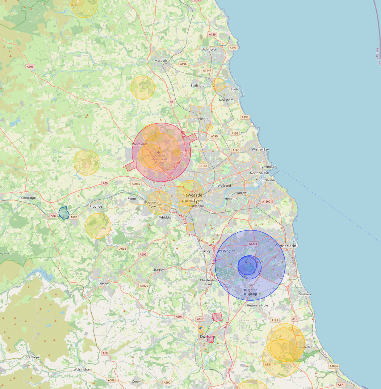
Newcastle International Airport CTR covers the north of the city. Network Rail manages Newcastle Central and the East Coast Main Line. The Tyne and Wear Metro is operated separately by Nexus with its own overflight rules.

Live flight restrictions and airspace zones around Newcastle
Live flight restriction data · Drone Safety Map View live airspace restrictions →
NCL CTR Network Rail Tyne and Wear Metro

Live airspace data from Altitude Angel via Drone Safety Map. Pan and zoom to explore restrictions around your site.

Where Newcastle upon Tyne clients send us

Common Newcastle upon Tyne project types.

Commercial property, public-sector housing, university estates, healthcare, heritage waterfront, manufacturing.

Why Newcastle upon Tyne firms use us

Permissions that match the airspace.

We cover Newcastle from a central operations base, so a same-week roof or thermal inspection is the norm, not the exception. No regional surcharge, no scheduling around a one-pilot diary.

Services in Newcastle upon Tyne

What we capture across the Newcastle upon Tyne area.

Local clients we work with

Public-sector and housing-association coverage.

Around Newcastle, our project pipeline regularly takes us across local authority and housing-association estates. We deliver scaffold-free roof inspections, retrofit thermography, condition surveys and BREEAM-grade thermal capture for organisations including:

Local authorities

  • Newcastle City Council
  • Gateshead Council
  • North Tyneside Council
  • South Tyneside Council
  • Northumberland CC

Housing associations & estates

  • Karbon Homes
  • Bernicia
  • Home Group
  • Your Homes Newcastle
  • Gentoo Group

Organisation names are common sector-active examples in the region. Specific client engagements are confirmed under NDA on request.

Permissions matter

Approved for business locations, airports, FRZs and restricted areas.

Most of the sites we're asked to fly, live commercial premises, near airports, inside Flight Restriction Zones, around Network Rail corridors, military air bases and Royal estates, require enhanced CAA permissions, prior notification, and an operator with the track record to coordinate with the relevant authority. We hold and operate under those permissions every day. If you've been told "no" elsewhere, our route to flying it is almost certainly already in place.

Powered by AIM

Newcastle upon Tyne captures, on AIM Platform.

Every Newcastle upon Tyne project we capture is hosted on AIM Platform, the asset-information software used by surveyors, councils and contractors across the UK. Browser-streamable. Measurable in place. Shareable with one link.

Recognised by
See AIM Platform → Watch a demo

Quote a drone survey in Newcastle upon Tyne.

Tell us the site, the deliverable, and any access constraints. Most quotes turn around within 24 hours.

Request a quote → See all locations
Request a quote Call us