Local clients we work with
Public-sector and housing-association coverage.
Around Oxford, our project pipeline regularly takes us across local authority and housing-association estates. We deliver scaffold-free roof inspections, retrofit thermography, condition surveys and BREEAM-grade thermal capture for organisations including:
Local authorities
- ✓Oxford City Council
- ✓Oxfordshire CC
- ✓Cherwell District
- ✓South Oxfordshire
- ✓Vale of White Horse
Housing associations & estates
- ✓Oxford City Housing
- ✓Sovereign Network Group
- ✓Soha Housing
- ✓Catalyst (Peabody)
Organisation names are common sector-active examples in the region. Specific client engagements are confirmed under NDA on request.
Common questions
Drone surveys in this area
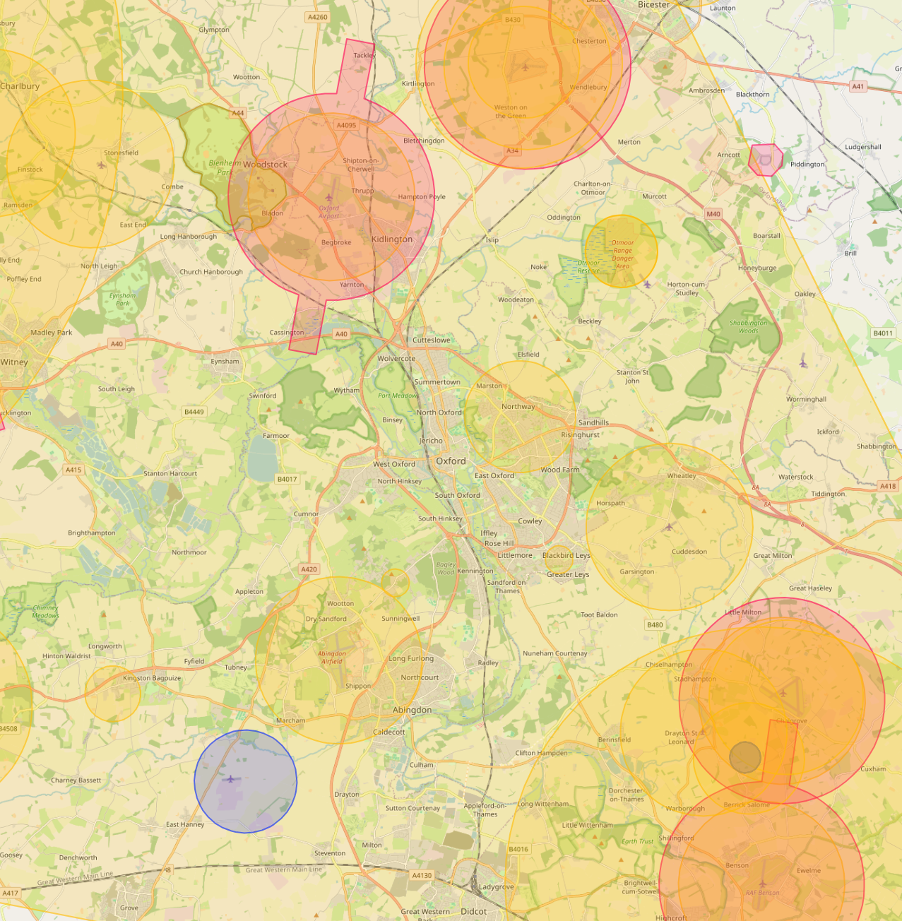
Can you fly drones near Oxford's controlled airspace?
Yes. We operate routinely under Oxford Airport CTR (Kidlington). Our enhanced CAA permissions and notification procedures let us fly safely in and around controlled airspace where standard operators are restricted, including airport approach paths and Flight Restriction Zones.
Do you cover Oxford central areas like City Centre and Jericho?
Yes. We routinely fly across Oxford including City Centre, Jericho and Headington. Dense built-up areas, occupied commercial premises and live retail sites are all within scope under our enhanced CAA approval.
Can you fly drones near Radcliffe Camera or other Oxford landmarks?
Yes, where permitted. Iconic sites like Radcliffe Camera sit within or near restricted areas, but we work with the landowner, the relevant authority and the CAA where needed to secure the right permissions. We have a strong track record of getting "no" sites to "yes".
Can you do construction progress monitoring on Oxford sites?
Yes. Monthly aerial sets, volumetric reports and orthomosaics for active Oxford construction sites are a core service. Each visit produces a side-by-side comparison against previous visits, hosted on AIM Platform.
What does a typical drone survey deliverable look like in Oxford?
You receive the captured imagery, measured outputs, and an interactive AIM Platform link for your team. Oxford jobs are deliverable in the same browser-based viewer used for projects across the UK, no software install, no per-seat licences.
How much does a drone survey in Oxford cost?
Most commercial drone surveys in Oxford range from £450 to £2,500 depending on site size, sensor type and turnaround. We quote firm within 24 hours of the brief, with no callout fees and no day-rate top-ups.