Commercial drone capture for Berkshire / South East England. CAA enhanced permissions, surveyor-led delivery, every project hosted on AIM Platform. From Reading city-centre roof inspections to estate-wide thermal surveys.
Heathrow Airport CTR covers Reading and the M4 corridor. RAF Farnborough sits 15km south-east. Network Rail manages Reading station and the Great Western Main Line and Crossrail terminus.
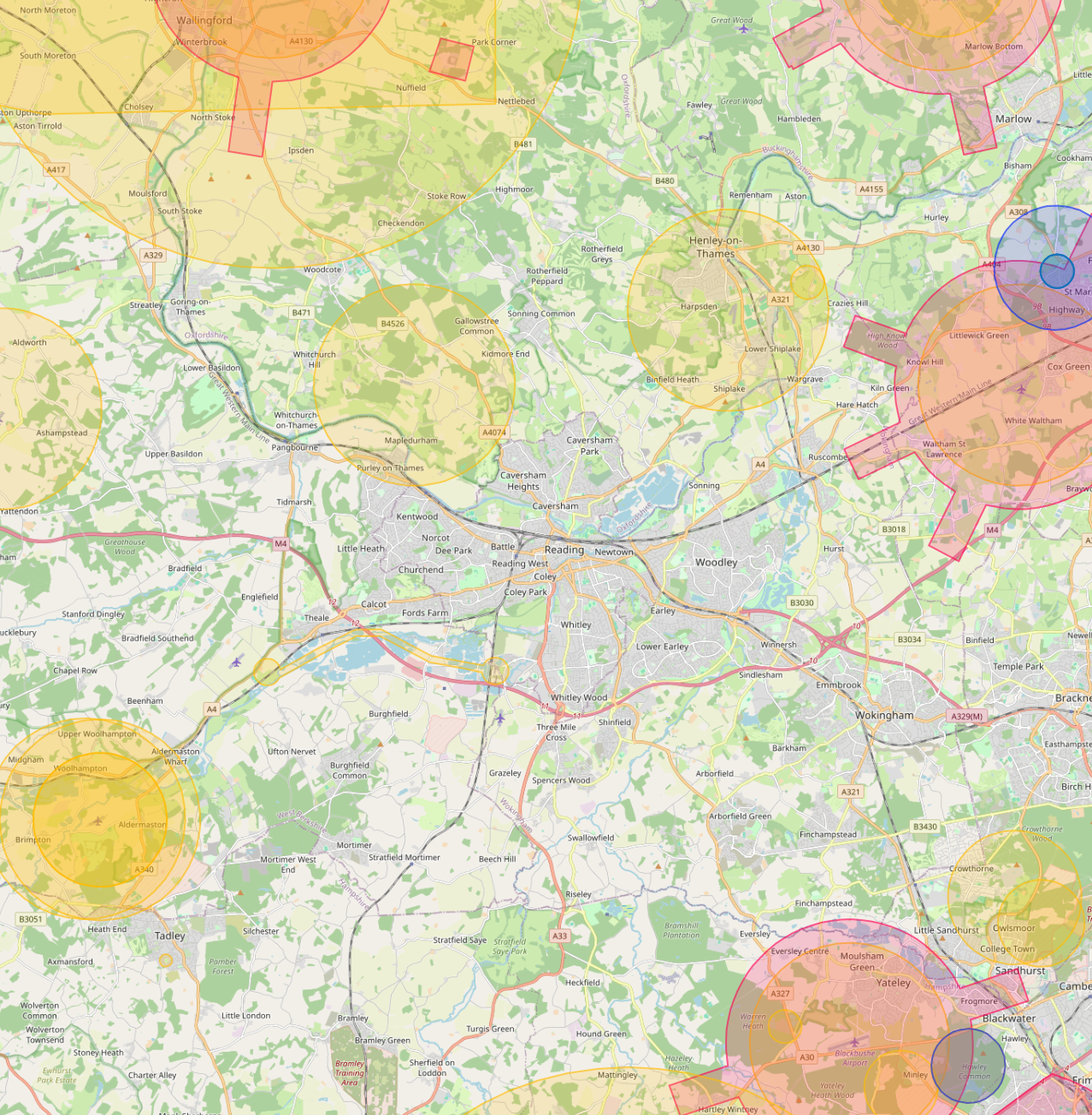
Live airspace data from Altitude Angel via Drone Safety Map. Pan and zoom to explore restrictions around your site.
Tech and business parks, commercial property, university estates, retail, public-sector housing.
Reading sits inside the Heathrow CTR with the Crossrail terminus in the centre of town, among the most complex airspace combinations outside London proper. We hold the enhanced permissions to operate here without delay.
Around Reading, our project pipeline regularly takes us across local authority and housing-association estates. We deliver scaffold-free roof inspections, retrofit thermography, condition surveys and BREEAM-grade thermal capture for organisations including:
Organisation names are common sector-active examples in the region. Specific client engagements are confirmed under NDA on request.
Most of the sites we're asked to fly, live commercial premises, near airports, inside Flight Restriction Zones, around Network Rail corridors, military air bases and Royal estates, require enhanced CAA permissions, prior notification, and an operator with the track record to coordinate with the relevant authority. We hold and operate under those permissions every day. If you've been told "no" elsewhere, our route to flying it is almost certainly already in place.
Every Reading project we capture is hosted on AIM Platform, the asset-information software used by surveyors, councils and contractors across the UK. Browser-streamable. Measurable in place. Shareable with one link.
Tell us the site, the deliverable, and any access constraints. Most quotes turn around within 24 hours.