Local clients we work with
Public-sector and housing-association coverage.
Around Wolverhampton, our project pipeline regularly takes us across local authority and housing-association estates. We deliver scaffold-free roof inspections, retrofit thermography, condition surveys and BREEAM-grade thermal capture for organisations including:
Local authorities
- ✓City of Wolverhampton Council
- ✓Walsall Council
- ✓Dudley MBC
- ✓Sandwell MBC
Housing associations & estates
- ✓Wolverhampton Homes
- ✓Bromford
- ✓Walsall Housing Group
- ✓Sandwell Homes
Organisation names are common sector-active examples in the region. Specific client engagements are confirmed under NDA on request.
Common questions
Drone surveys in this area
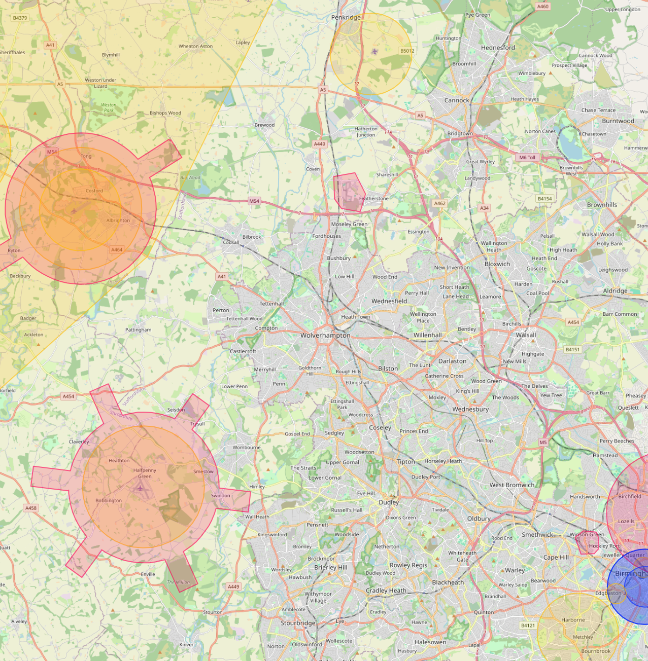
Can you fly drones near Wolverhampton's controlled airspace?
Yes. We operate routinely under Birmingham Airport CTR (20km east) + Wolverhampton Halfpenny Green ATZ. Our enhanced CAA permissions and notification procedures let us fly safely in and around controlled airspace where standard operators are restricted, including airport approach paths and Flight Restriction Zones.
Do you cover Wolverhampton central areas like City Centre and Bilston?
Yes. We routinely fly across Wolverhampton including City Centre, Bilston and Tettenhall. Dense built-up areas, occupied commercial premises and live retail sites are all within scope under our enhanced CAA approval.
Can you fly drones near Molineux Stadium or other Wolverhampton landmarks?
Yes, where permitted. Iconic sites like Molineux Stadium sit within or near restricted areas, but we work with the landowner, the relevant authority and the CAA where needed to secure the right permissions. We have a strong track record of getting "no" sites to "yes".
How much does a drone survey in Wolverhampton cost?
Most commercial drone surveys in Wolverhampton range from £450 to £2,500 depending on site size, sensor type and turnaround. We quote firm within 24 hours of the brief, with no callout fees and no day-rate top-ups.
What does a typical drone survey deliverable look like in Wolverhampton?
You receive the captured imagery, measured outputs, and an interactive AIM Platform link for your team. Wolverhampton jobs are deliverable in the same browser-based viewer used for projects across the UK, no software install, no per-seat licences.
Can you fly drones during Wolverhampton working hours without disturbing the site?
Yes. Our enhanced CAA permissions let us operate at 10m from people and property while sites are live and occupied, so Wolverhampton commercial buildings can stay operational throughout the survey.